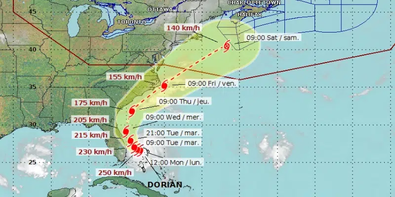
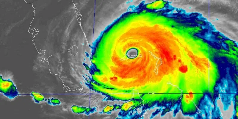
Hurricane Dorian, which has been pummeling the Bahamas as it crawls towards Florida, has been downgraded to Category 4.
The Canadian Hurricane Centre is keeping a close eye on the immense storm as it bears down on the southeast coast of the United States.
The slow-moving and powerfully destructive storm is forecast to skirt along the Florida coast by tomorrow with winds above 200 km/h. It will eventually weaken as it heads back out to sea by Friday.
Keep an Eye on the Forecast
A local meteorologist says Dorian still carries the potential to impact Newfoundland later in the week.
It will lose a considerable amount of strength as it creeps up the Eastern Seaboard, but PAL Airlines and Aerospace meteorologist Brian Walsh says we could fee the effects by Friday.
His advice is to keep on top of the forecast, especially if you have travel plans for Friday through Sunday.
You can see its track on the Environment Canada website.
This is what the peak of the Atlantic hurricane season looks like. Besides Hurricane #Dorian, there are 4 other areas of interest being monitored by @NHC_Atlantic. As of now, the only one showing any potential impacts to Newfoundland is what’s left of Dorian this weekend #nlwx pic.twitter.com/Cg6zfT6vNY
— Brian Walsh (@BrianWalshWX) September 2, 2019


