A system bringing a wintry mix of high winds, rain and snow is expected to ease off later this evening, but conditions may greatly vary depending on where you are.
Conditions suddenly deteriorated in St. John’s-metro as torrential rains mixed with high winds seemingly caught drivers by surprise. Several collisions were reported to the VOCM Newsroom during a short period.
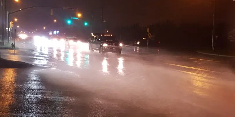
Areas of the Avalon—including St. John’s-metro—could see upwards of 70mm of rain by the time the weather runs its course.
While rainfall is one thing to contend with, Environment Canada says inland areas and those in higher terrain are more likely to see snow accumulate through evening.
The Burin Peninsula will see a mix of rain and snow peter off tonight, but not before coastal areas see upwards of 45mm of rain. Inland areas are likely to encounter 10 centimetres before it changes back to rain.

Meanwhile, parts of Central are contending with heavier snow, and high winds.
Environment Canada put out weather warnings for much of central, the interior of the island, and down towards the Connaigre Peninsula. Upwards of 20 centimetres of snow is expected for inland areas, and in higher terrain.
Officials are urging caution as heavy rain is causing water to pool on roadways, and snowfall may suddenly reduce visibility.
Care is advised if you’re hitting the road.