What a difference a day makes. It was a record-breaking day for temperatures in some areas of the province yesterday, but the tail end of the system is bringing bad weather.
Wanda Batten a meteorologist with Environment Canada, says there were record temperatures almost across the island.
A high of 14.4 degrees Celsius was recorded at St. John’s international airport marking the warmest December 15 since records were kept in 1874, toppling the previous record of 12.4 degrees, set in 1919.
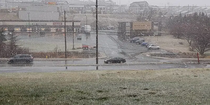
Batten says the weather is going to be starkly difference today compared to yesterdays warm temperatures. The East and Avalon will see snow squalls and blowing snow, but the west will get hit hard.
She says the back side of this system is starting to move through with lots of warnings in effect for the island. For the west and down to Burgeo there is a blizzard warning in effect with lots of snow. High winds will create near zero visibility with severe snow squalls that will last a couple of days.
Many schools are closed or delayed and Marine Atlantic has cancelled its daytime sailings from Port aux Basques and North Sydney, due to the weather conditions, with crossings tentatively set to resume at 11:45 p.m.
A winter storm warning is also in effect for parts of Labrador, from Churchill Valley into Labrador City, Wabush, and the Nain region.
10 centimetres of snow is expected, with winds gusting up to 80 km/h through overnight.
There is also another system they are watching that could hit the island on Thursday.