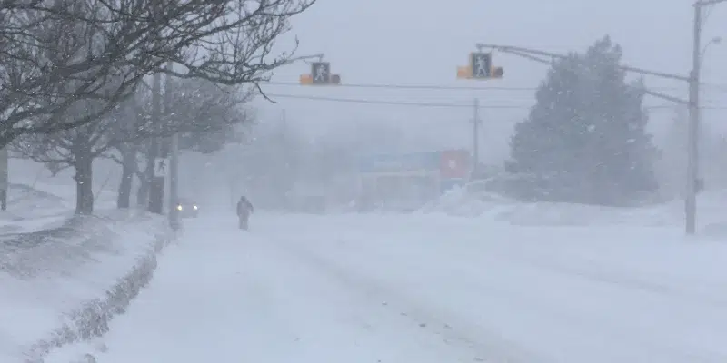
Some areas of the Northern Avalon Peninsula may be surprised by blizzard-like conditions this afternoon.
A trough of low pressure forming a narrow band of snow is hanging around and will pick up through the afternoon and into the evening.
David Neal, Meteorologist with the Gander Weather Office says wherever the system sets up it will produce pretty nasty conditions including heavy snowfall and blowing snow as the winds pick up in Avalon Peninsula North, Bay de Verde Peninsula, and Clarenville.
Neal says snowfall totals will vary depending on where you are. He says 5 cm is expected for most areas. However, under the intense snow squall band, some areas could see upwards of 20 to 30 cm by the time the system moves out this evening.
The metro area could see around 10 cm throughout the evening hours.
Neal says it’s tricky to forecast as it’s not a typical snow squall system, as the weather will be lingering in the same area. He is cautioning those driving on the Northern Avalon to be careful of snow squalls.
He says it’s best to stay off the roads if you don’t have to travel. It could be beautiful in one area, but a short distance away there may be a localized blizzard.