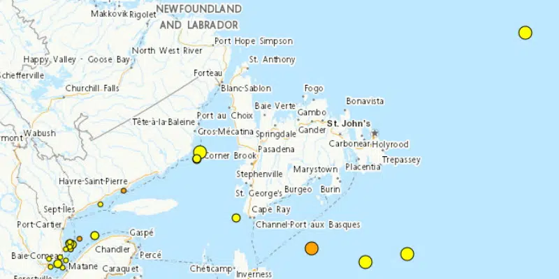
It may come as a surprise to some to learn that the area off the south coast of Newfoundland that generated the deadly tsunami of 1929, still sees fairly regular seismic activity.
The massive 7.2 earthquake on the Laurentian slope southeast of Marystown on November 18, 1929 caused a large marine landslide, creating a tsunami that devastated the Burin Peninsula.
Twenty-eight people lost their lives when their homes were inundated.
Natural Resources Canada seismologist, Claire Perry says the same general vicinity generates an average of 2 to 3 magnitude 4 earthquakes, and an average of a dozen magnitude 3 tremors a year.
She says it was a “double event”—that is, the shaking caused by the initial 7.2 quake, followed by a massive undersea landslide—that triggered the tsunami and sets it apart from routine seismic events in the offshore.
Natural Resources Canada is in the process of installing land seismometers as part of a national earthquake early warning system. Perry says it’s hoped similar ocean seismometers will be next.
That will provide them more time to send out warnings and allow people to prepare in the event of a possible tsunami.
A 3.9 magnitude quake was recorded close to 600 km east of St. John’s on August 19, while two quakes, registering 3.6 and 3.7, were recorded south southwest of Marystown on August 15.


