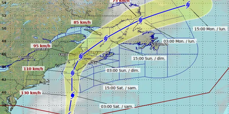
Hurricane Lee is forecast to reach the Maritimes tomorrow in the form of a post-tropical storm.
Lee will weaken by the time it makes landfall in the area of the Bay of Fundy, bringing gusty winds and heavy rain to parts of southwestern Nova Scotia and southern New Brunswick.
The storm will then veer off, passing through the Gulf of St. Lawrence and the Straits Sunday through Monday with wind gusts of up to 75 km/h.
The MHA for Burgeo Lapoile, Andrew Parsons, acknowledges that the residents of his district are still deeply affected by the damage caused by Hurricane Fiona nearly one year ago. He says watching the latest storm is causing some anxious moments even if the storm isn’t expected to have a significant impact on this province.
He says, “Even myself…I feel it. I’m keeping a closer eye than perhaps I ever did on these weather advisories,” and he says it’s even worse for those who lost homes and loved ones. He reminds that help remains on the ground for residents who are struggling.
In the meantime, Warning and Preparedness Meteorologist with Environment Canada, Bob Robichaud, says Lee is very different from Fiona.
The biggest difference, says Robichaud, is the intensity of the storm when it arrives. The storm is bigger, but far weaker, “nothing like what we saw with Fiona last year.”
Marine Atlantic has issued an advisory to travelers indicating that crossings on the Cabot Strait could be affected by Hurricane Lee both Saturday and Sunday.
Marine Atlantic spokesman Darrell Mercer says they’re watching the latest advisories from the Canadian Hurricane Centre very closely.


