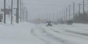
Snowfall is continuing to intensify across the Avalon Peninsula as a result of the region’s first significant storm of the season.
About 10 to 15 cms is expected to accumulate in the metro region throughout the early part of the system with another 10 to 15 cms expected through the evening hours and into the overnight.
A total of up to 30 cms of snow is expected over the northeast Avalon region before the snow dies off overnight.
Environment Canada meteorologist Ian Hubbard says winds will also start to pick up, causing blowing snow and drifting.
Wind gusts are expected to hit 60 km/h by late this evening with gusts as high as 80 km/h along parts of the coast through the overnight hours.
That wind will continue through to tomorrow evening after the snow peters out, resulting in blustery conditions for the better part of Saturday.
Slippery roads have already contributed to several accidents in the metro area, including a single-vehicle rollover near Soldiers Pond on the Trans-Canada Highway.
No serious injuries have been reported.
Earlier story
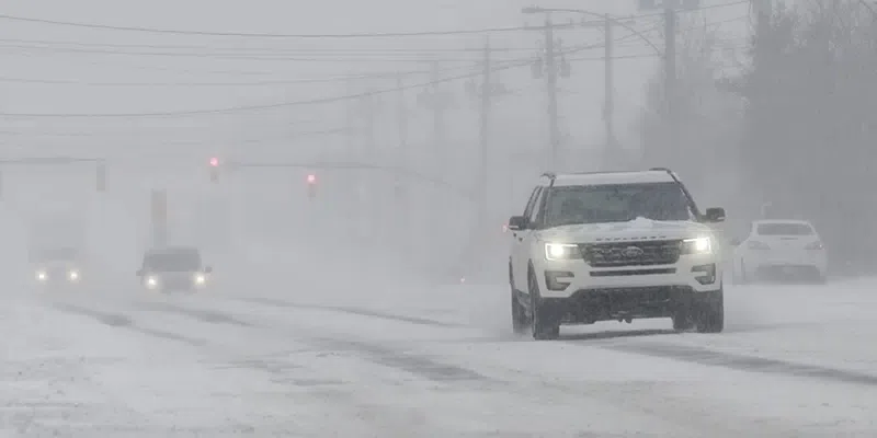
The freezing rain has wrapped up but snow is on its way as the eastern half of the island.
The metro region and northern Avalon is looking at 20 to 30 cm of snow with winds picking up throughout the day. The southern Avalon will see higher snowfall amounts up to 35 cm, while Clarenville-Bonavista area and the Burin Peninsula will see slightly less. Snowfall will be the most intense this evening.
All St. John’s-metro area schools are closed for the day, as well as others throughout eastern Newfoundland.
Meteorologist with the Gander Weather Office, Angelie Menard, says while snowfall is expected to wrap up before Saturday morning, conditions may still be treacherous.
She says winds may ramp up to 80 km/h for the Northern Avalon and Bonavista Peninsula on Saturday, with onshore flurries.
Conditions will improve as the winds ease to start the week.

Capital City Prepared for First Major Snowfall of the Season
The City of St. John’s is ready for today’s snow storm.
Deputy City Manager of Public Works Lynnann Winsor says city crews have been busy preparing for the first major snowfall of the season.
She says crews have been out even before the snow starts to fall.
That begins with trucks applying salt to city streets, while plows are sent out once the snow starts to accumulate.
Once the snow falls the priority will be on major thoroughfares and high traffic roads, with residential streets lower on the list.
Generally speaking, while it’s not always predictable what timelines Mother Nature might have in store, Winsor says the best-case scenario for city snow clearing crews involves storms that wrap up in the overnight hours. That allows equipment to complete the clean up before people are up and trying to get about on city streets.