Winds have picked up and heavy rain and snow is falling across most of the island as what some call a “bomb cyclone” – or intensifying storm passes over the island.
Environment Canada has issued a range of weather statements and warnings as the storm’s effects will be felt throughout most of the province both today and tomorrow.
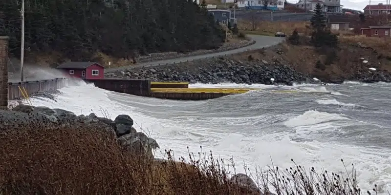
Coastal flooding warnings in effect for Burin and Southern Avalon
Meteorologist David Neil says warnings are in place about storm surge and elevated water levels along south-facing coastlines on the Burin Peninsula and southern Avalon.
“There’s a higher chance that these areas could experience some low-level flooding…mainly near high tide this evening, but for some areas it could also linger into high tide on Wednesday morning” says Neil.
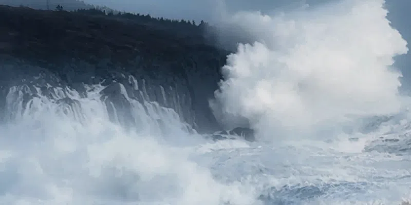
Waves crashing into cliffs at Lower Island Cove January 5, 2025. Photo credit: Eugene Howell
Storm surge and coastal flooding warnings in effect for NE Coast tomorrow and rest of the week
A second coastal flooding warning is also in effect for the northeast coast from the Bay of Exploits to the Bonavista Peninsula after the storm passes.
“Areas that are lower-lying exposed more to the north. The highest risk there for any flooding is really near high tide starting Wednesday morning and really going through the much of the rest of the work week, right through to Friday morning.”
Coastal flooding statements are also in place for the rest of the island.
Wind warnings also in effect
Winds are also a major factor over the next 24 hours, with winds gusting as high as 120 km/h on the southern Avalon and in the 90 to 110 km/h range for other parts of southern and eastern Newfoundland.

Rainfall amounts could reach 50 mm in some areas, snow in higher elevations on west coast, Northern Peninsula and parts of Labrador
Rainfall warnings are in effect for central Newfoundland where up to 50 mm could fall between now and later tonight. Amounts could push 50 mm for parts of eastern Newfoundland as well.
Central and western Newfoundland, including the Northern Peninsula and parts of Labrador will see snow in higher elevations with accumulations expected, mixed with rain.
Neil says snow is mixing in with rain earlier than anticipated with accumulations reported from Corner Brook to Gander.
RCMP warn that driving conditions through central Newfoundland and the west coast are treacherous.

Transportation affected with airline and ferry cancellations
Some flights at St. John’s international Airport this afternoon have been cancelled, and ferries between Newfoundland and Nova Scotia are tied up today and tomorrow.
The Bell Island ferry is also down. Garbage collection in some municipalities has also been affected.