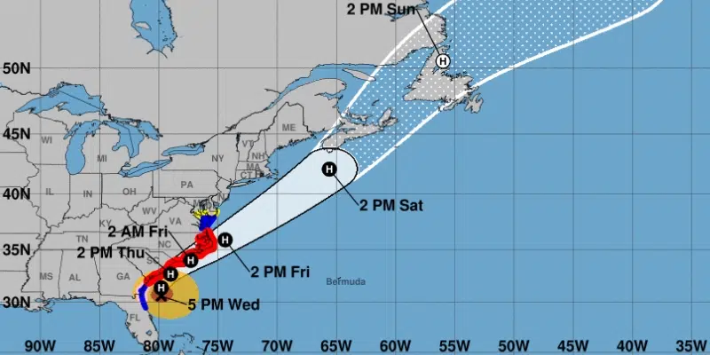
The west coast of the island will bear the brunt of what is left of Hurricane Dorian by the time it arrives to the province.
While Dorian is expected be downgraded to a post-tropical storm by the time it reaches Atlantic Canada, meteorologists are cautioning that damage is still very possible with rain, high winds and waves.
Jean-Marc Couturier, Meteorologist with the Canadian Hurricane Centre says it will arrive Saturday night.
He says hurricane force southeasterlies will develop over the west coast on Saturday night and as the storm passes, winds will shift to hurricane force northwesterlies. Couturier says at this point it doesn’t look like winds will affect central or southeastern Newfoundland.
Wind gusts are projected up to 100 km/h, or 130 km along the west coast, with moderate winds for Gander to St. John’s of up to 70 km/h.
The west could to see up to 60 mm of rain, less than 10 mm is expected for Eastern Newfoundland. The storm is tracking to go north with parts of southern Labrador possibly seeing up to 75 mm of rain.