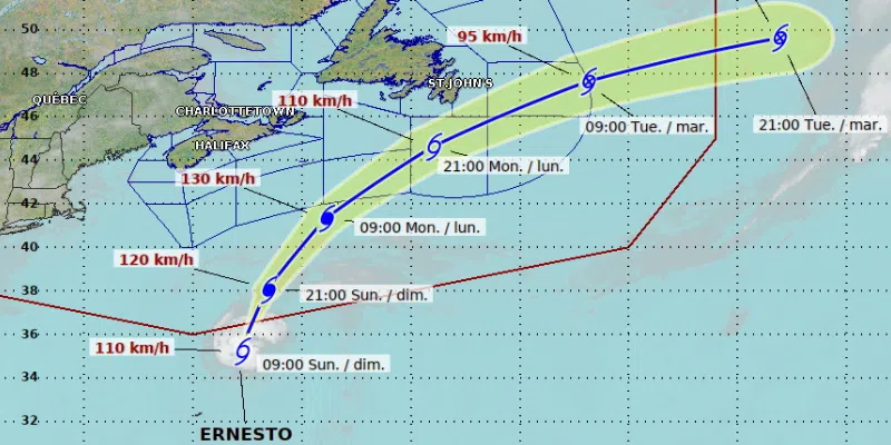
Hurricane Ernesto is expected to bring some wind and rain to the southeastern portion of the island late Monday.
Ernesto is slowly making its way toward Canadian offshore waters, and Environment Canada has a tropical cyclone information statement in effect for parts of Newfoundland.
The system is expected to track near the Avalon Peninsula including St. John’s-metro, the Bonavista Peninsula, the Burin Peninsula, and the Clarenville area.
Environment Canada’s latest update this morning says Ernesto will be transitioning into a post-tropical storm as it passes south of the Avalon Peninsula of Newfoundland later Monday.
As the system passes south or near the Avalon Peninsula, a short period of heavy rain is possible over a three to six-hour window.
Environment Canada says there will be large breaking waves which could cause some coastal flooding for the southern Avalon and Placentia Bay. Minor damage to docks and coastal structures is possible.
For southeastern Newfoundland large waves will arrive and build from the southwest Monday night, and will diminish on Tuesday.