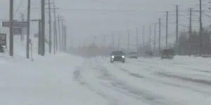
A “classic nor’easter” will hit the island on Monday, and while the jury is still out on the exact track it looks like eastern Newfoundland will get its first significant dumping of snow this year.
Environment Canada meteorologist David Neil says the system will move off the US east coast on Sunday and “intensify pretty quickly,” before heading toward the Avalon peninsula early in the day on Monday.
Neil says the biggest uncertainty right now is how close to the Avalon it is going to track, and how quickly it is going to move. “but what’s looking increasingly certain is that a portion of eastern Newfoundland is going to see a good shot of heavy snowfall and some very strong winds.” He says there is uncertainty on how far west the impacts will be.
In terms of exactly how much snow could be seen , Neil says there is a range of scenarios based on the track – with some models bringing the snow into central.
On the lower end, models are predicting 10 to 20 cm in the east, with other models suggesting 20 to 30+ cm.