The province is experiencing drought-like conditions, the likes of which have not been seen in more than a decade.
Tinder-dry ground cover is helping to fuel wildfires that are devastating parts of the province—and Conception Bay North in particular.
Environment Canada says the last time precipitation levels for the eastern portion of Newfoundland were as low as they have been this summer was back in 2012, but even then, the dry spell didn’t last as long as what we’re seeing now.
Meteorologist Crawford Luke says while there is some precipitation in the forecast later this week, it will remain relatively dry for the rest of the month.
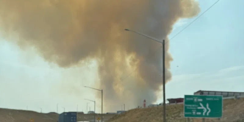
Paddy’s Pond fire from Mount Pearl (submitted photo)
“Thursday, Friday probably, we might get into a chance of showers, but again, now sure it’s going to be anything too substantial. As we look long-term it looks like we’re probably going to remain on the dryer side for much of August.”
Luke says respite may come from tropical storms that will make their way north along the US eastern seaboard, but in recent weeks, any precipitation heading our way has been pushed back over the Atlantic by a high pressure ridge that has been sitting over the region since July.
“Basically it’s just being deflected eastwards because of that upper ridge that’s just parked itself over eastern Canada.” He says typically, tropical storms start making a run for Atlantic Canada in September and October, but “we really could use one of those to help with the rainfall problem right now.”