Just as things dry up following the latest rainstorm to hit the island, another deluge is on the way.
Rainfall amounts as high as 94 mm was recorded at St. Lawrence from last night’s storm, up to 78 mm at the Berry Hill station in Gros Morne National Park, and 50 to 60 mm in the metro region.
Now, another system is heading our way starting tomorrow and running through to Friday according to Environment Canada meteorologist Ian Hubbard.
He says another low pressure system will bring rain and wind to the island starting tomorrow morning over parts of the south coast and spreading to the northeast Avalon by afternoon or early evening. 30 to 50 mm of rain is expected over parts of the Avalon and south coast with high winds.

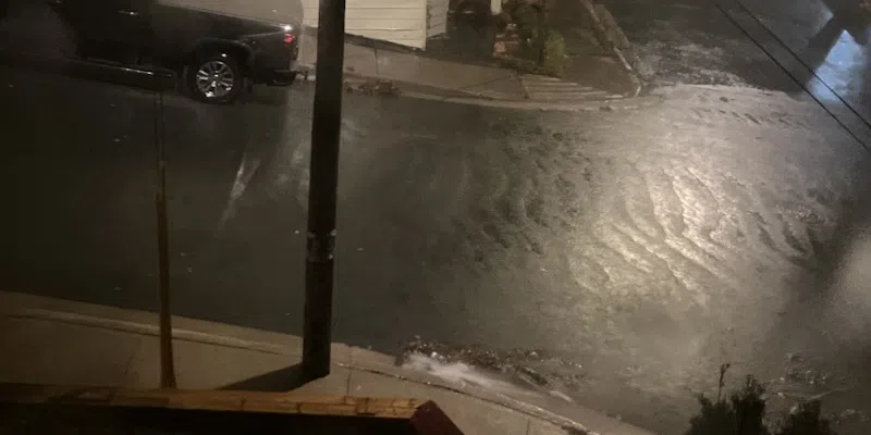
Standing water on Elizabeth Avenue, November 4, 2025 (VOCM News)
St. John’s has already seen 126 mm of rain so far this month, which is approaching the rainfall average for November. Hubbard says the high pressure system that had been blocking rainfall and caused drought-like conditions through the summer and early fall has finally dissipated.
He says low pressure systems have been able to develop and track over the island, with high precipitation levels over most areas.
Water levels starting to rise on major water systems in central, western Newfoundland
It appears as though recent rain and snow systems are starting to make a difference in water levels in central and western Newfoundland.
While there’s still a way to go, water levels on the Exploits River below Noel Paul’s Brook rose by a quarter of a metre thanks to yesterday’s rain storm.
Meanwhile, water levels on the Exploits near Millertown also rose to approximately 1.9 metres from a low of 1.7 just a couple weeks ago.
Water levels at Beothuk Lake have just crept above the low supply level for the first time in weeks.
Howley resident Derek Murphy placed a stick in Grand Lake on November 3rd after taking drone images of how much the water had receded. He checked again this morning and it showed an improvement of more than 6 inches.

Howley resident Derek Murphy staked a pole along the shoreline of Grand Lake back on November 3rd and checked it again on November 12th (Derek Murphy)