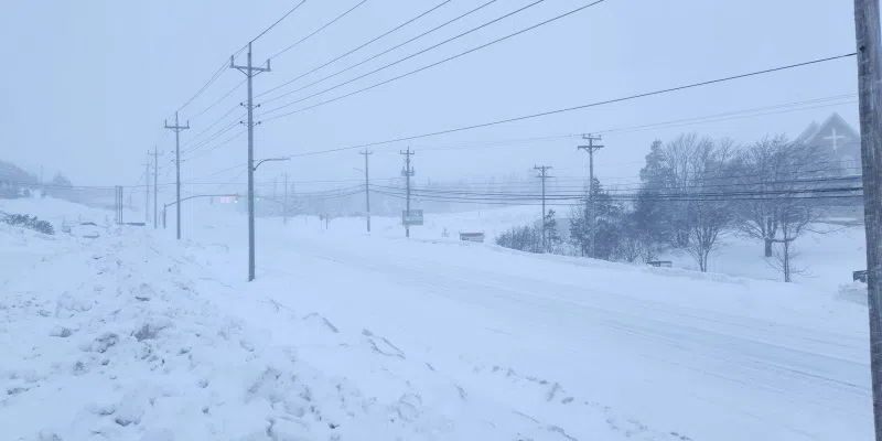
Forecasters are predicting what could be one of the worst storms of the season, and the province is preparing to batten down for a dumping of 35-50 cm of snow on the Avalon Peninsula, possibly more.
Winds are expected to gust between 80 and 100 km/h through Monday, with snowfall starting just before dawn.
Veronica Sullivan with Environment Canada says the Metro region is expecting about 5 cm of snow per hour throughout the day.
“There are pockets of snow that could even accumulate past 50 cm,” she told VOCM News on Saturday. “We’re expecting the snow to begin in the late overnight hours of Monday morning, so perhaps around 3 a.m., and that will quickly intensify. We could get some pretty intense snowfall rates with this storm; upwards of 5 centimetres per hour is very likely.”
Veronica Sullivan Speaks with VOCM’s Zack Power on the latest weather system set to hit the province Monday:
An orange weather watch has been issued for the eastern half of the island, with Central under a yellow watch. In Central, 15-35 cm of snow is on the way, coupled with high winds.
Environment Canada has also issued a Coastal Flood Warning for southern portions of the island, where the snow is expected to switch to rain around lunchtime.
1. Our next #NLwx system will be a powerful winter storm.
Snow arrives Sunday overnight for south & east, very early Monday AM elsewhere.
Snow may change to ice pellets and rain for the Avalon & Burin Pens Monday, then back to snow Monday eve/night.
Precip tapers Tuesday AM. pic.twitter.com/jrk1fxhget
— Kelly Butt (@kellymbutt) January 30, 2026
Coastlines from Cape Freels to the Burin Peninsula are the most at risk, according to Sullivan. She says a near-full moon, high tide, wind, snow, and rain are all contributing factors to the warning.