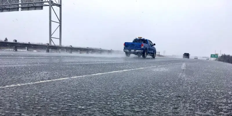
The east coast of the island will remain on the cold side of a low pressure system passing over the Avalon Peninsula, bringing an extended period of freezing rain with it.
That means tomorrow’s morning commute could be tricky with an accumulation of ice on roads, parking lots, and walkways.
The city of St. John’s says it’s on the ready with a mix of salt and sand to keep roads safe.
A freezing rain warning is out for the eastern portion of the island, and a special weather statement has been issued for other areas which are expected to get snow.
Environment Canada meteorologist Jim Prime says the temperature will continue to drop, and the precipitation will turn to freezing rain and snow later this evening.
He says that will continue through the night for between 8 and 14 hours with up to 10 mm expected.
He says the temperature will hover around the freezing mark meaning some areas could see more rain, while others will see glitter.
“If people look out their windows in the morning and say ‘ah! we didn’t get any freezing rain, everything’s fine,’ well just a little ways away it might actually be more freezing rain, especially if there’s some higher terrain.”
He says temperatures will rise tomorrow afternoon, turning back to rain for the east coast. Gander and areas further west could see more ice pellets and snow to start before the freezing rain begins.
Prime says luckily, the system isn’t bringing much wind.
He says without stronger winds, the risk of power outages is not as great. The real concern come morning will be slippery roads and walkways.