A nice day is on tap for most of the island today, but things quickly turn south tomorrow as the remnants of what was hurricane Laura move in.
Laura was at one time a category 4 hurricane and caused significant damage as it passed through Louisiana and Texas earlier this week.
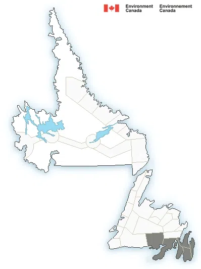
Environment Canada has issued special weather statements for the Avalon and Burin Peninsulas, as well as the Connaigre region.
Environment Canada meteorologist Justin Boudreau says the circulation that was Laura is now “pretty much gone” and what will be moving through tomorrow is simply a low-pressure system, but it will be packing a bit of a punch.
Between 40 to 60 mm is expected in southeastern Newfoundland, with more possible in localized areas. Winds will be strong, between 70 to 80 km/h.
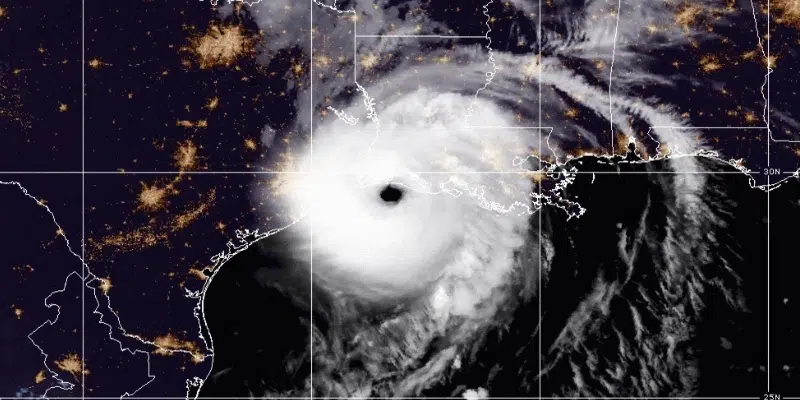
Hurricane Laura, not long after making landfall in the United States. Via the National Oceanic and Atmospheric Administration