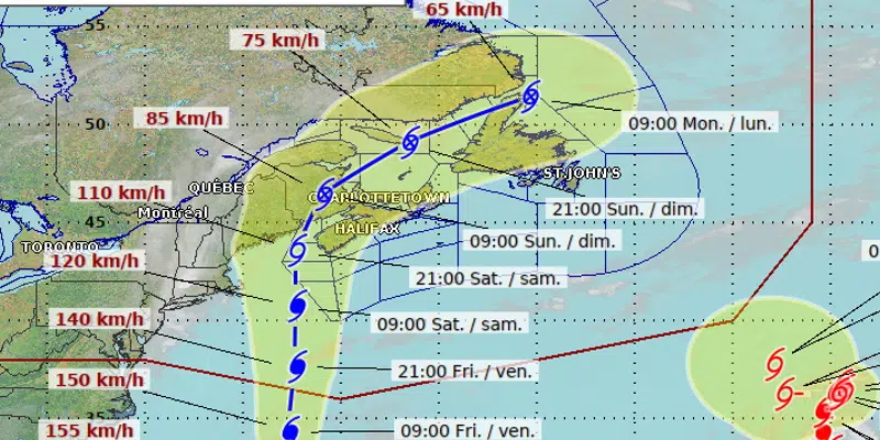
The forecast track of Hurricane Lee is becoming clearer with the storm expected to weaken and reach the Bay of Fundy on Saturday as a tropical storm.
According to the latest models, the storm will then track through the Gulf of St. Lawrence and pass through the Straits affecting portions of south east Labrador and the west coast and central Newfoundland.
David Neil with the Environment Canada weather office in Gander says Lee’s greatest impact will be felt in the Maritimes and Maine with rainfall and gusty winds. By the time it reaches Newfoundland and Labrador, the storm will have weakened even further, although some gusty winds and heavier periods of rain are expected for the west coast and southern portions of Labrador.
“We’ll see some effect from Lee” says Neil, with winds picking up from the East Southeast starting on Saturday.
More precise wind and rain forecasts will be issued in the coming days as the storm draws closer.