A hurricane expert says despite a relatively quiet start, it has been an average hurricane season thus far.
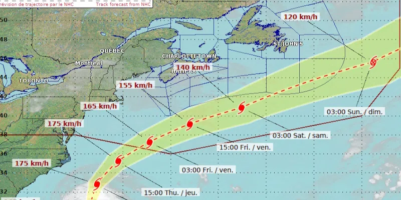
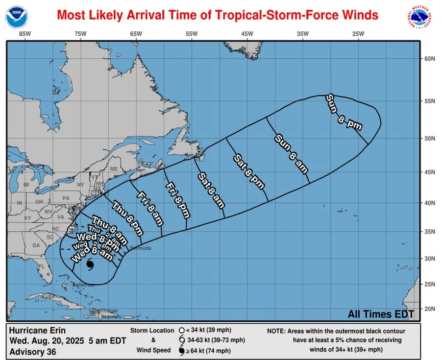
Meteorologists are currently tracking the path of Hurricane Erin. While the eye of that storm is expected to stay well offshore, Environment Canada says it is on track to bring huge waves to Eastern Canadian waters and south-facing Atlantic coastlines of Nova Scotia and Newfoundland. It looks like the eastern-most area of Newfoundland will see high winds Friday night and Saturday.
(National Hurricane Center)
Athena Masson, a Florida-based hurricane expert, says the season usually produces its “E” named storm around this time of year, which puts Erin on par with what is expected.
She cautions that activity in the Atlantic basin is expected to ramp up, however, as we are now in the peak of hurricane season.
She says the peak time is from now until mid-October. “We’re going to start to see storms explode, and we’re already monitoring two other systems coming off of Africa and moving towards the west that have a pretty good chance of developing. So, peak of the season’s here, we just have to continue to monitor them.”