A woman who lost her home in the fire in Conception Bay North is echoing the many questions evacuees are asking about the fire, how it started and the decisions made to battle the blaze.
Stella Johnson lost her home in Northern Bay, but wants to know how the fire got to the point of reaching the community in the first place.
The fire, which started in Kingston on August 3rd, got as far as Northern Bay Sands, where her home, and many others, burned down on August 14th.
The fire also consumed her sister’s business, Johnson’s Garden Nursery.
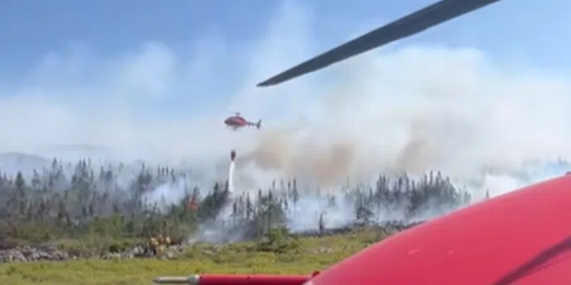
“Really there was no need,” says Johnson, “if we had had help…that day on the 14th and the 15th, with a water bomber, we would not have burnt.” She says she watched a waterbomber on the 14th, “it came after it left Paddy’s Pond, it arrived at the top of Northern Bay, and it started dumping water 4 o’clock that afternoon. It put the fire out…but of course the next day, the 15th of August, mothering happened. No-one came.”
The fire stopped its progression at that point when the winds changed.
Johnson, a former teacher, told VOCM Open Line with Paddy Daly, someone started the fire, and people are demanding answers.
“Paddy, this is the big thing, what’s going on with this arsonist investigation? Is that going to happen again like next week? Two weeks? Or two years down the road? Something has to be done.”
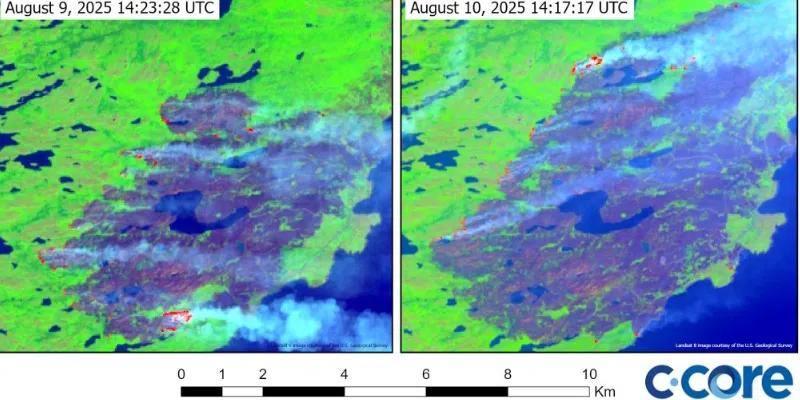
Growth of Kingston fire between August 9th and 10th (C-Core)
Satellite images show rapid growth of ‘Kingston fire’
A local company has collected satellite data from a variety of sources including the U.S. Geological Service, the European Space Agency and the Airbus Defence and Space satellites to map two major wildfires burning on the Avalon in August.
In one set of images, graphics generated from the USGS Landsat-8 satellite show how the fire, which started in Kingston, grew from August 9th to the 10th.
Imagery also shows how the Paddy’s Pond fire, close to major power infrastructure and some populated neighbourhoods, showed no significant growth between August 13 and 17th.
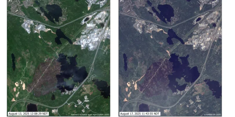
Little change shown in the growth of the Paddy’s Pond fire between August 13th and August 17th (C-Core)