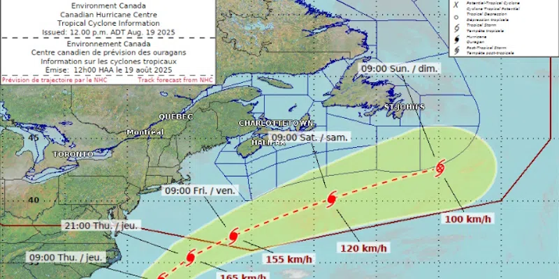
Newfoundland and Labrador seems to be in the clear as it relates to any direct impacts from Hurricane Erin, but the storm’s outer bands could bring some precipitation for the island.
That’s according to Dr. Athena Masson (MASS-in), a hurricane specialist based in Florida, who spent time studying in this province.
Masson says Erin is currently in the Bahamas.
As the system is pulled to the north it will expand, and could become 10 times larger than what it was in the tropics.
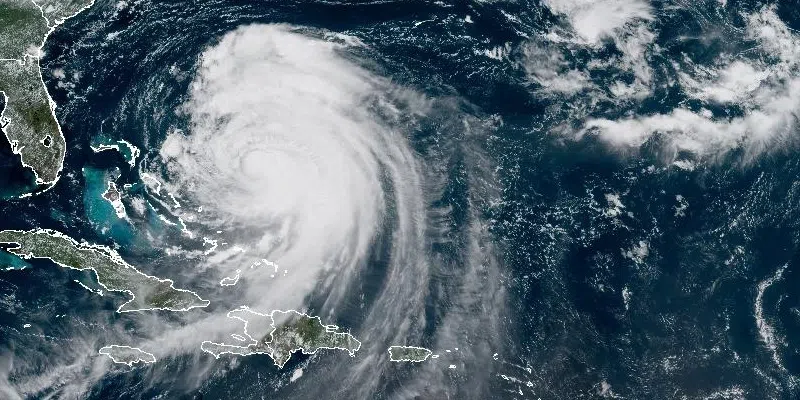
Hurricane Erin via the National Hurricane Center in the U.S.
Masson says that is something this province should pay attention to because the outer bands of the storm system will really “blow out” as it gets into our neck of the woods towards the weekend.
Masson says wind and rain will be the biggest concern for the province.
Because of the wildfire situation, she hopes some of the outer bands of the storm stretch out enough so it can give the island more much-needed rain.
Masson doesn’t think the province will see any intense rainfall, however, as the storm is expected to be very fast moving by the time it passes by the province. She says Friday and Saturday will be the time when any impacts are felt.