Just days after Newfoundland was bathed in temperatures in the mid to high 20°s, people were left reeling Thursday with the sudden appearance of “June-uary” weather.
Rainfall mixed with wet flakes, and was in some cases replaced with snow, as temperatures dipped near the freezing mark.
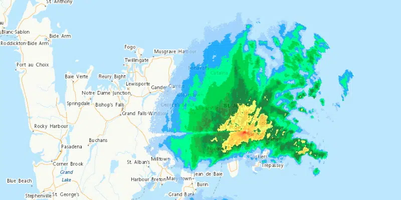
(The Holyrood weather radar shows snowfall working its way across the island, as of 6 p.m. on Thursday.)
The snow began to work its way eastward across the island throughout the day, resulting in some accumulation along central and northeastern regions. Drivers were advised to use caution as conditions along roadways also deteriorated.
By mid-afternoon, photos began surfacing of thick layers of accumulation along the Northern Avalon, while areas of higher elevation throughout metro were also subjected to the late reminder of winter.
As of 6:30 p.m., one centimetre of accumulation had been reported at St. John’s International Airport.
St. John's #YYT reporting 1 cm of snowfall as of 6:30 pm. Temperature 0.2°C.https://t.co/lse57XopUN#nlwx #Juneuary pic.twitter.com/5Zxc4iWHhE
— Rodney Barney (@rcbstormpost) June 10, 2021
Environment Canada says upwards of five centimetres of accumulation is possible for some areas. However, the snow is not expected to be present for very long, as it will taper off to scattered showers by midnight tonight.
Temperatures return to the double digits across the island tomorrow.
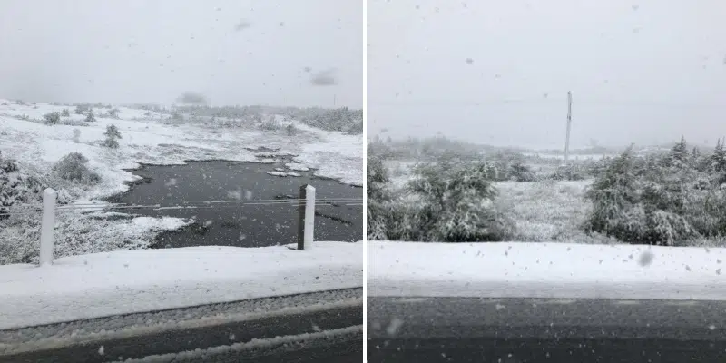
#nlwx yes it’s June 10!!!! Only in Newfoundland!!! In Chapel Arm we are able to make a snowman 🤦♀️😳 and still snowing!! @EddieSheerr @a_brauweiler @kellymbutt @rcbstormpost @weathernetwork pic.twitter.com/QQmuZTE32f
— Alisha Reid (@Alisha_Reid) June 10, 2021
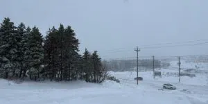
If ya got summer tires on or ride a motorcycle stay home in Clarenville area. #nltraffic pic.twitter.com/XYcC60ac7s
— Sandy (@dasandman1968) June 10, 2021
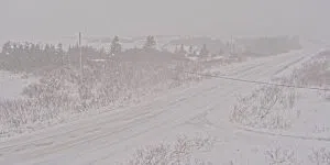
Snowing in Holyrood. #nlwx pic.twitter.com/Clqv4nvHxg
— Tanya Keats (@tlkeats73) June 10, 2021