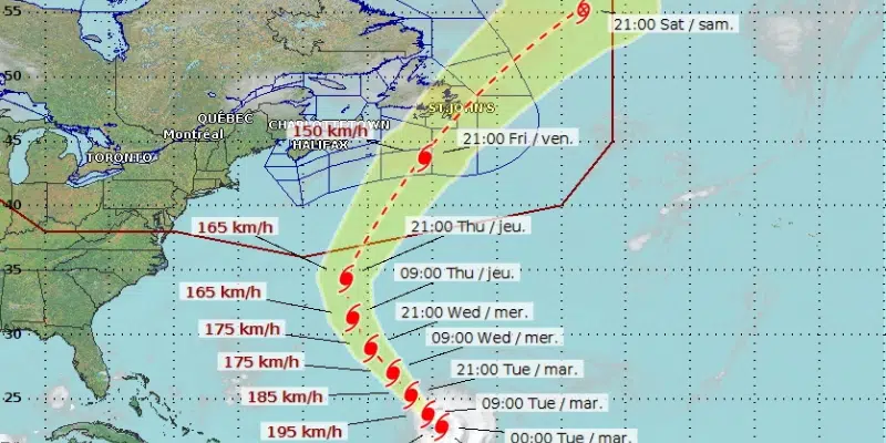
Forecasters now say Hurricane Larry is likely to influence the weather in eastern Newfoundland this Friday as it travels across the Avalon Peninsula.
Most of the models according to the Canadian Hurricane Centre show it transitioning to a post-tropical storm.
The Centre says, at this point, it’s unlikely that the hurricane will re-intensify in a manner such as Igor in 2010.
Large ocean waves will arrive along the Atlantic coast off Nova Scotia and southern Newfoundland Thursday. The waves will be particularly large on Friday, presenting a hazard to those close to the water.
Derm Kearney, a meteorologist at the Gander Weather Office, says mariners should keep an eye on the storm but it’s too soon to give specifics on wind and rain. Larry has the potential to deliver hurricane-force winds to the Grand Banks.
He says it’s a very large cone of possibilities with the Burin Peninsula, the Avalon, and offshore.
The next update comes tomorrow morning at about 9:30 a.m. NDT.