


Hurricane-force winds are on the way as part of a weather system that is creating some messy conditions across the island.
While snow changed to rain on the eastern portion of the island, all areas west of Gander are getting significant snowfall, up to 40 cm in some areas.

Road conditions at Lewisporte as of this morning (via Government of NL)
Winds are expected to pick up tonight. Gusts could reach between 130 km/h and 140 km/h on the Avalon and along the northeast coast, while in central, gusts will reach about 90 km/h.
The worst of the winds will come in the overnight hours.
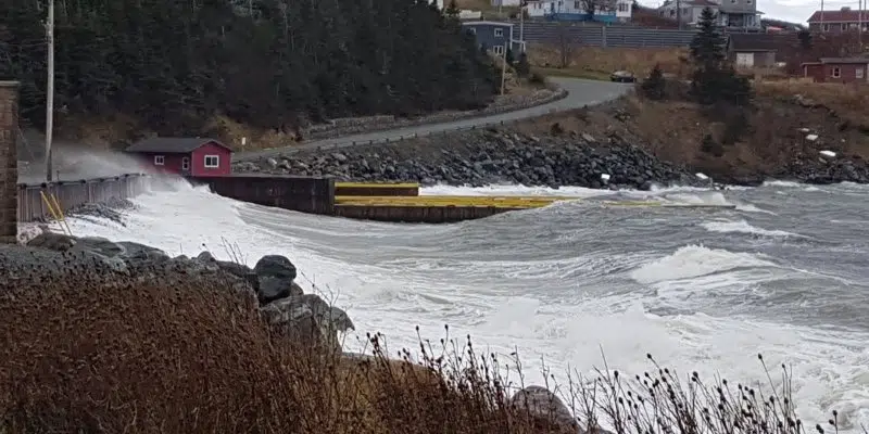
And as if things weren’t bad enough, according to Environment Canada meteorologist Tiffany Cheeks, there is also a coastal flooding statement in effect for the northeast coast.
With the strong winds, she says there will be pounding surf and large waves, and elevated water levels are expected in and around high tide.
Cheeks says the weather will settle down tomorrow, though some gusty winds will persist throughout the morning.


