A prolonged winter storm which is going to hit most parts of the island in some manner is set to strike mid-week with some astounding amounts of snow possible.
Compounding matters will be high northerly winds with gusts to 80 km/h.
Mike Vandenberg, a meteorologist at the Gander Weather Office, says early projections are for 30 to 50 cm of snow, but he says amounts could exceed 50 cm.
A mixture of rain may keep the total amount down on the Avalon, while the west and southwest coasts are just outside the storm circle.
He says the system is just going to sit there to the east of the island for 36 to 48 hours beginning on Wednesday.
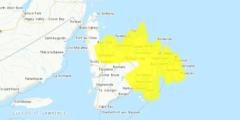
The storm circle basically takes in the zone from St. John’s to Harbour Breton in the south, central Newfoundland, the east coast and northeast coast, and the lower part of the eastern side of the Northern Peninsula.
It’s expected to begin snowing Wednesday morning with things ramping up throughout the day.


