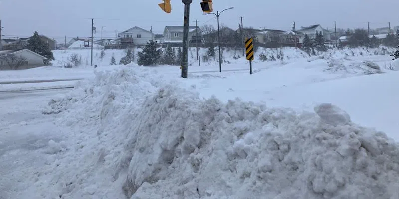
Expect some pretty intense and messy weather conditions during the morning commute tomorrow as Mother Nature sends more snow our way.
While most areas of the island will see some impact from the latest fast-moving system, the Avalon and Burin Peninsulas will see the highest snowfalls.
Environment Canada meteorologist David Neil says while there won’t be much in the way of snow – just 5 to 10 cm – it’s the intensity and high winds that will cause the biggest headaches tomorrow morning.
Neil says that “in a short period of time it is going to be quite intense, so you’re going to have poor visibility, and it’s going to accumulate pretty quickly.” The temperature will rise above freezing turning to rain and drizzle and making the snow that falls tomorrow heavy to move. “It’s just going to compound what’s been a challenging week or so for these areas of the province,” Neil says.
A special weather statement has been issued for the Burin and Avalon peninsulas.